 I'll update later if possible, but pay heed to NWS warnings and if reports continue to come in of 70-80MPH winds, it wouldn't be a bad idea to head to the lowest level and center part of your house. Remember, a severe thunderstorm warning doesn't indicate a lower danger than that contained within a tornado warning, it only indicates a different type of danger. Severe thunderstorms can produce winds that easily cause more damage than many tornadoes. Have a good and safe night everyone!
Saturday, June 19, 2010
More Storms Tonight
After a record breaking derecho tracked from eastern Nebraska all the way to Ohio yesterday we have been rocked with two significant thunderstorm events, one last night that produced storms to the north, and another coming in from the northwest earlier this afternoon which produced some scattered tree damage around the area with 60MPH+ winds. But, tonight, another bow echo (which is basically a line of thunderstorms with a bloated midsection indicating higher winds) is approaching from the west. It currently lies west of Topeka, but is packing potential 80MPH+ winds, and, as is always possible with bow echos, the chance for brief, but strong, spin-up tornadoes. We're under a severe thunderstorm watch until 3AM, and unless the thunderstorms weaken, we'll be in for a very significant event tonight. I didn't blog about the event earlier today for a number of reasons, one, it was a broken line, and, two, the reports weren't of extensive damage. I knew wind damage would be sparse, but tonight's situation may be a different story. Please take care to secure all outdoor furniture that could become debris in straight-line winds. Here is a graphic of the watch area: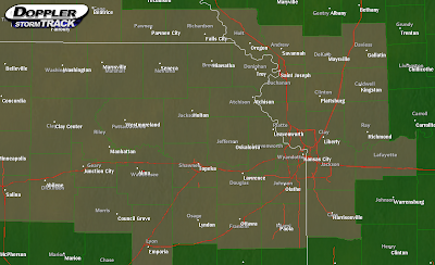 I'll update later if possible, but pay heed to NWS warnings and if reports continue to come in of 70-80MPH winds, it wouldn't be a bad idea to head to the lowest level and center part of your house. Remember, a severe thunderstorm warning doesn't indicate a lower danger than that contained within a tornado warning, it only indicates a different type of danger. Severe thunderstorms can produce winds that easily cause more damage than many tornadoes. Have a good and safe night everyone!
I'll update later if possible, but pay heed to NWS warnings and if reports continue to come in of 70-80MPH winds, it wouldn't be a bad idea to head to the lowest level and center part of your house. Remember, a severe thunderstorm warning doesn't indicate a lower danger than that contained within a tornado warning, it only indicates a different type of danger. Severe thunderstorms can produce winds that easily cause more damage than many tornadoes. Have a good and safe night everyone!
Subscribe to:
Post Comments (Atom)

No comments:
Post a Comment