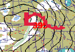
NWS EAX forecast discussion updated; appears that local forecasters believe the supercells may persist long enough to enter our area and, especially with the triple point so close by, continue to have the potential to contain tornadoes. The relevant part of the discussion follows.
SEVERE THUNDERSTORMS SHOULD ERUPT THROUGH CENTRAL PORTIONS OF KANSAS. GIVEN THE AMPLE SHEAR AND THE ORIENTATION OF THAT SHEAR ACROSS THE DRYLINE SUPERCELLS WILL BE LIKELY. THIS ACTIVITY WILL SHIFT TO THE EAST WITH THE TRIPLE POINT LIKELY TO BE IN WESTERN PORTIONS OF THE FORECAST AREA. WHAT IS VERY CONCERNING WITH THIS POTENTIALY SIGNIFICANT SEVERE EVENT IS THAT DUE TO STRONG FORCING AND STRONG SURFACE WINDS...THE ENVIRONMENT MAY STAY SURFACE BASED WELL INTO THE EVENING AND EVEN CLOSE TO MIDNIGHT. WITH HIGH HELICITY VALUES WITHIN THE WARM SECTOR AND VERY HIGH SHEAR WE COULD SEE SUPERCELLS PERSISTING WELL AFTER DARK WITH TORNADOES A DISTINCT POSSIBLY.
PREVIOUS ENTRY BELOW
*************************
3 days away from a massive storm system that will eject into the plains creating the potential for significant severe weather, and yet the forecast is still too complex to make any accurate predictions. The latest SPC SREF (short range ensemble forecast) run will be out at any time. . . and if it's anything like the last run, KC will be deep within the prime zone for supercell development, and on the edge of an unusually high (5-7) significant tornado parameter. Interestingly, the SREF models have been trying to push to dryline with 60+ dew points farther north and east. Today's GFS and ECMWF runs have kept the surface low in far south central KS for 00z (7PM) Tuesday, and keeping the highest CAPE values in north OK and south KS- possibly over 3000 j/kg. The SREF runs have KC on the northeast edge of high Craven-Brooks parameters, and within an area of significant tornado ingredients sometime after 00z Tuesday. It looks as though the LLJ (low level jet) will force the dryline very quickly to the north and east, along with the SFC (surface) low, moving north of KC sometime in the early morning hours of Tuesday. Whether or not the cold front will overtake the dryline and whether or not KC will be north or south of the warm front will likely be major players in our severe weather threat. If strong low level winds push the cold front into the dryline, our severe weather threat would primarily be late night linear hail producers and strong wind gusts. If the dry line can stay isolated from the cold front, then shear profiles will likely be more favorable for continued supercell thunderstorms late into the night, although eventually a linear squall will develop somewhere. Thunderstorms are likely earlier in the day as the warm front moves northward, and if the front stays south of KC late into the afternoon, large hail could be a significant threat right around the front. If the warm front moves through, extreme low level moisture and sufficient temps will put KC in the warm sector, and thunderstorms forming along the dryline, north to the triple-point, and points east will likely be supercellular with explosive development and a high probability for vertical rotation. Right now, the likeliest area for significant tornado development (primarily to do this area being protected from much of the model uncertainty) is south central / southeast KS into northeast OK sometime in the afternoon. If the low moves faster as some GFS runs have suggested or a strong cap holds until late evening, this risk area will likely shift closer to KC. We'll have to wait for further model trends before making an accurate prediction, one which will likely wait until Monday morning. Right now, none of the models seem to be able to consistently plot the warm front, putting KC in a zone of major uncertainty. Regardless, strong thunderstorms with large hail and gusty winds will be very likely overnight Monday into early Tuesday morning. But, our strategic placement within the warm sector and position of the SFC low/dry line will likely be major players in our supercell and tornado threat.
Somewhere in the plains there is likely to be a significant tornado outbreak- but where? We'll just have to speculate for now.
Below is the current GFS 00z surface setup for Monday night. Warm front position right now, like I said, is more of a guessing game than anything.


So, I was wondering how you got started in the 'weather' business?
ReplyDelete